Dumoine Tote Road Trail Information

Maps, access points, trail conditions and more!

Sunrise on the river
Sunrise on the Dumoine River

This trail allows people of all skill levels to enjoy at least some of the trail's twenty six kilometres forming what can only be described as a spectacular wilderness river hike.

Trail description

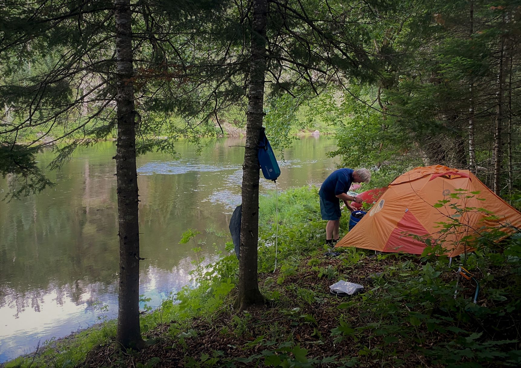
The Dumoine Tote Road Trail is unique in Canada as it combines hiking along a protected wild river, over historic Anishnabee portage trails, and following a recreated logging road built 150 years ago. You will be walking through beautiful old growth forests with lush undergrowth, wildlife sounds, signs and sightings, and camping at old log drive campsites. You may choose to day trip from campsites accessible by boat in the south and by car in the north, or do the full twenty-six-kilometre hike through from either end. This trail is very flat with only a 75m elevation range across the entire 26 kilometers, but a full elevation profile is available to view if you'd like. This is a wilderness hike with no services other than primitive campsites, no cell phone reception, and no trail staff other than volunteers. It is well blazed and continues to evolve into one of the great hikes through nature and history. This website is your best source for up-to-date information.

A man setting up a tent beside the Dumoine River
Setting up camp along the Dumoine River

How to use the Interactive Web Map

Note: this map was designed to be used on desktop; not all features are available on mobile.

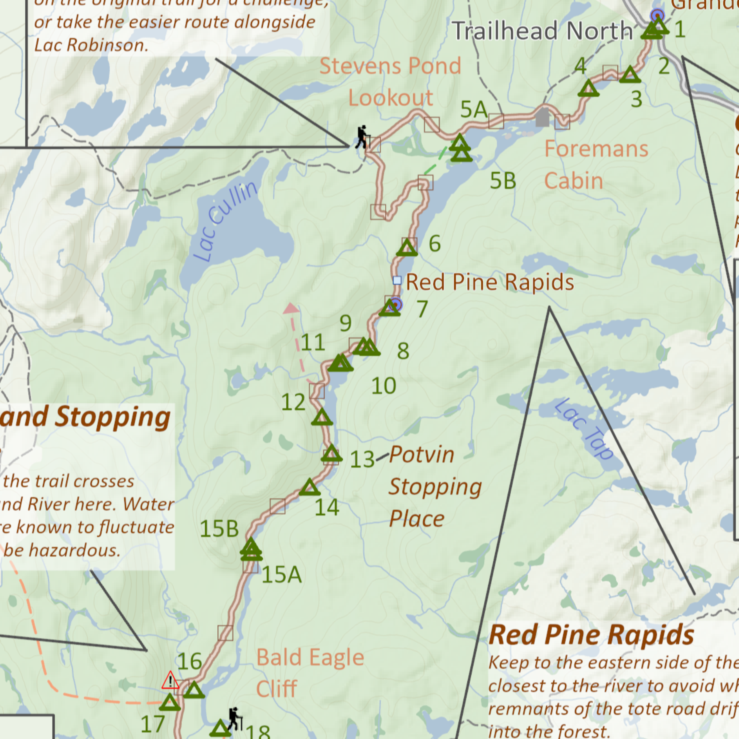
The interactive web map is the perfect way to get acquainted with the Dumoine Tote Road Trail before you begin your adventure. It offers the chance to get a feel for the terrain, natural landmarks, campsites, access points and more to ease the planning process.

Once you open the map, use your mouse's scroll to zoom in and out and click and drag the map to pan around. If you prefer, you can also use the zoom buttons located in the top-right corner of the map. There is also a scale bar in the lower portion of the map.

The campsite information panel on the side provides details about every site along the trail: if you click on a campsite name in the list, the map will zoom to that site on the map for you. Similarly, if you click on a campsite icon on the map, the matching listing will be highlighted in the informational side panel (you may have to scroll through the listings to find it).

All features on the map are interactive:

  • hover over a campsite icon to learn its name
  • hover over a side trail, point of interest or boat launch to get more information
  • click on a yellow-highlighted trail segment to learn about its historical significance
  • click on the highlighted road segments to get more details about driving directions to the trailhead
  • click on a bright orange shape to learn about historical stopping places
  • right-click, hold and drag the map to change the perspective of the view
Lastly, the legend is available to you to toggle layers on and off in the top left corner of the map. If you would only like to see campsites, simply uncheck the boxes for all other layers in the legend and they will disappear from the map. To make them reappear, check the box in the legend again.

Happy exploring!

Go to the web map

Trail Maps

Trail Access

There are several outfitters offering a shuttle service to either the northern trailhead on Chemin Dumoine or the southern trailhead on the Ottawa River. It is highly recommended that you rely on a shuttle service because the roads to the northern trailhead are rough and not suitable for many vehicles. A detailed list of recommended outfitters and guides is available on our outdoor resources page.

Take me there

Driving Directions

The northern trailhead is accessible via logging roads in Zec Dumoine by entering through the town of Rapides-des-Joachims, QC. Follow Chemin Dumoine for 13 kilometers, then turn left at the fork onto Chemin Grande Chute and continue for 13 more kilometers, following the Zec Dumoine signs. The trailhead will be on your left after you cross the bridge at Grande Chutes. Please note that the roads are rough and there is limited parking on the side of the road at the trailhead.

Google Maps

Fees

You must buy a trail permit from Zec Dumoine after the entrance bridge in Rapides-des-Joachims and a road pass from Zec Rapides-des-Joachims after the exit bridge from the village. For more details, visit their website.

Zec Website

Trail Conditions

Weather

Fildegrande River Crossing
Crossing at the Fildegrand River

Water Levels

The water levels of the Dumoine and Fildegrand Rivers fluctuate drastically between seasons. In the spring, crossing the Fildegrand around kilometer marker 16 on the trail will be challenging. You are encouraged to verify the historical average monthly water levels prior to heading out on the trail. A current posting of water level information can also be found via Quebec's Ministry of Environment for the Dumoine River station.

Cookfire beside the Dumoine River
A cookfire beside the Dumoine River

Fire Safety

In the summer months, there is the possibility of fire bans being put in place. Be sure to consult SOPFEU's website before heading out on the trail: no campfires should be lit along the trail if a fire ban is in place.

Emergency Information

The Dumoine Tote Road Trail is a wilderness trail with no services, no cell phone reception, and few options to exit quickly. You should always carry a first aid kit, water filter, shelter and food, fire starter and some way to send messages (i.e. satellite phone or Spot or GPS messenger commercial options).

Evacuation Times

The first southern five kilometres from the Ottawa River to Ryan's Chute are accessible by power boat and an evacuation could be made that way back to the launch sites listed on the Ontario side (3 hours).

Similarly, the first five northern kilometres of the trail are near a Zec Dumoine gravel road suitable for trucks, ATVs, and SUVs. It is a 46 km drive (2 hours) to the nearest hospital in Deep River, Ontario.

The sixteen kilometres between these two exit options is a zone where you would have to be evacuated by canoe, ATV or by helicopter. First responders will have a time-consuming and difficult time reaching and evacuating you to a place where a boat, vehicle or helicopter could reach you (12-24 hours).

Zec-specific Emergency Information

When you purchase a road, parking and trail permit from Zec Dumoine it includes the search and rescue support from Air Medic. Air Medic would initiate a plan for your rescue which could involve helicopter, bush road vehicle and/or boat rescue. They would coordinate with their search and rescue partners in the area to execute a plan. They need to know your location, either using a GPS point or the nearest trail marker, so please pay attention to these markers.

Police

If it is a police matter, you are in Quebec, so it is a Sûreté du Quebec (not OPP) jurisdictional matter. The closest base is in Campbells Bay which is a 1hr40min drive to Rapides-des-Joachims: dial 911 or for non-emergency dial 819-648-5689.

Forest fire

If you see a forest fire, try to get upwind of it into a clearing or ideally to a lake/river shoreline. Use wet clothing or blankets as a defence. Self-evacuate as soon as possible and call 911.

Conservation Officer

If you observe unusual aggressive animal behaviour or someone breaking conservation laws, report it to the Zec Dumoine office.

Emergency Phone Numbers

You should always leave your wilderness travel itinerary with a friend at home and check with them at the start and end of your trip. Aside from this, carry (in a waterproof notebook with your communication device) your emergency health, emergency contact person and insurance information and the following phone numbers:

  • Your shuttle driver's cell or home phone number
  • ZEC Dumoine: 1 (613)-586-1966
  • Deep River Hospital: (613) 584-3333